What is Photogrammetry?
Photogrammetry, when combined with drones, becomes a cutting-edge technology that revolutionises the way we capture and reconstruct three-dimensional information. Drone-based photogrammetry involves deploying an uncrewed aerial vehicle equipped with a high-resolution camera to capture a series of overlapping still images of an area or an object from different angles and altitudes.
These images are then processed using specialised software that analyses the overlapping features and extracts precise measurements and spatial data. By leveraging the GPS coordinates and onboard sensors of the drone, photogrammetry can accurately reconstruct the topography, architecture, and intricate details of the surveyed area.
The use of drones in photogrammetry offers significant advantages such as increased accessibility to remote or hazardous areas, rapid data acquisition, and the ability to cover large expanses efficiently. It has found applications in diverse fields like land surveying, urban planning, agriculture, and environmental monitoring, enabling professionals to make informed decisions based on accurate and highly detailed 3D models generated from drone-captured imagery.
Sir Tatton Sykes monument from 784 still images
Building Collapse from 468 still images
3D Photogrammetry Abandoned Barn
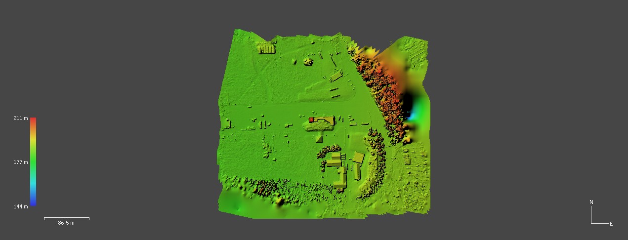
What is a Digital Elevation Model (DEM)?
A digital elevation model (DEM) derived from drone technology is a digital representation of the Earth’s surface that captures elevation data in a three-dimensional format. Drones equipped with specialised sensors, such as LiDAR (Light Detection and Ranging) or photogrammetric cameras, are deployed to capture detailed information about the terrain from above. As the drone flies over the area of interest, it collects data points by measuring the distance between the sensor and the ground surface.
These data points are then processed using advanced algorithms to create a high-resolution DEM. The resulting model provides a comprehensive depiction of the elevation variations and topography of the surveyed area, enabling precise measurements of heights, slopes, and contours. Digital elevation models derived from drone technology are utilised in a range of applications, including land surveying, urban planning, environmental monitoring, and natural resource management. They play a crucial role in terrain analysis, flood modelling, infrastructure development, and other fields that require accurate and detailed elevation information for decision-making and analysis.
Digital Elevation Model of collapsed Building site